


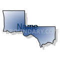
Cowlitz, Pacific & Wahkiakum Counties PUMA, Washington
About
Outline

Summary
| Unique Area Identifier | 194337 |
| Name | Cowlitz, Pacific & Wahkiakum Counties PUMA |
| State | Washington |
| Area (square miles) | 2,676.78 |
| Land Area (square miles) | 2,336.16 |
| Water Area (square miles) | 340.62 |
| % of Land Area | 87.28 |
| % of Water Area | 12.72 |
| Latitude of the Internal Point | 46.37418740 |
| Longtitude of the Internal Point | -123.26976060 |
Maps


Graphs
Select a template below for downloading or customizing gragh for Cowlitz, Pacific & Wahkiakum Counties PUMA, Washington


Neighbors
Neighoring Public Use Microdata Area (by Name) Neighboring Public Use Microdata Area on the Map
- Clark County (North)--Battle Ground City & Orchards PUMA, WA
- Columbia, Lincoln, Clatsop & Tillamook Counties PUMA, OR
- Grays Harbor & Mason Counties PUMA, WA
- Lewis, Klickitat & Skamania Counties PUMA, WA
Top 10 Neighboring County (by Population) Neighboring County on the Map
- Clark County, WA (425,363)
- Cowlitz County, WA (102,410)
- Lewis County, WA (75,455)
- Grays Harbor County, WA (72,797)
- Columbia County, OR (49,351)
- Clatsop County, OR (37,039)
- Pacific County, WA (20,920)
- Skamania County, WA (11,066)
- Wahkiakum County, WA (3,978)
Top 10 Neighboring County Subdivision (by Population) Neighboring County Subdivision on the Map
- Longview-Kelso CCD, Cowlitz County, WA (63,510)
- Astoria CCD, Clatsop County, OR (24,939)
- St. Helens CCD, Columbia County, OR (23,425)
- Castle Rock CCD, Cowlitz County, WA (14,789)
- La Center CCD, Clark County, WA (14,770)
- Woodland CCD, Cowlitz County, WA (10,923)
- Scappoose CCD, Columbia County, OR (9,504)
- Long Beach-North Beach Peninsula CCD, Pacific County, WA (9,107)
- Yacolt CCD, Clark County, WA (8,744)
- Raymond CCD, Pacific County, WA (7,892)
Top 10 Neighboring Place (by Population) Neighboring Place on the Map
- Longview city, WA (36,648)
- St. Helens city, OR (12,883)
- Kelso city, WA (11,925)
- West Side Highway CDP, WA (5,517)
- Woodland city, WA (5,509)
- Longview Heights CDP, WA (3,851)
- Raymond city, WA (2,882)
- Kalama city, WA (2,344)
- Castle Rock city, WA (1,982)
- Columbia City city, OR (1,946)
Top 10 Neighboring Unified School District (by Population) Neighboring Unified School District on the Map
- Battle Ground School District, WA (65,182)
- Longview Public Schools, WA (45,370)
- Kelso School District, WA (28,482)
- St. Helens School District 502, OR (20,637)
- Washougal School District, WA (19,168)
- Ridgefield School District, WA (13,923)
- Astoria School District 1, OR (13,648)
- Woodland School District, WA (11,971)
- Ocean Beach School District, WA (10,032)
- Castle Rock School District, WA (9,891)
Top 10 Neighboring State Legislative District Lower Chamber (by Population) Neighboring State Legislative District Lower Chamber on the Map
- State House District 18, WA (160,083)
- State House District 20, WA (141,029)
- State House District 35, WA (138,142)
- State House District 15, WA (132,788)
- State House District 19, WA (126,904)
- State House District 31, OR (62,690)
- State House District 32, OR (60,293)
Top 10 Neighboring State Legislative District Upper Chamber (by Population) Neighboring State Legislative District Upper Chamber on the Map
- State Senate District 18, WA (160,083)
- State Senate District 20, WA (141,029)
- State Senate District 35, WA (138,142)
- State Senate District 15, WA (132,788)
- State Senate District 19, WA (126,904)
- State Senate District 16, OR (122,983)
Top 10 Neighboring 111th Congressional District (by Population) Neighboring 111th Congressional District on the Map
- Congressional District 1, OR (802,570)
- Congressional District 3, WA (779,348)
- Congressional District 6, WA (709,570)
Top 10 Neighboring Census Tract (by Population) Neighboring Census Tract on the Map
- Census Tract 15.02, Cowlitz County, WA (7,918)
- Census Tract 9715, Lewis County, WA (7,092)
- Census Tract 7.04, Cowlitz County, WA (7,029)
- Census Tract 9, Cowlitz County, WA (7,008)
- Census Tract 8, Cowlitz County, WA (6,727)
- Census Tract 16, Grays Harbor County, WA (6,661)
- Census Tract 16, Cowlitz County, WA (6,330)
- Census Tract 9705, Columbia County, OR (6,287)
- Census Tract 403.02, Clark County, WA (6,256)
- Census Tract 9702, Columbia County, OR (6,154)
Top 10 Neighboring 5-Digit ZIP Code Tabulation Area (by Population) Neighboring 5-Digit ZIP Code Tabulation Area on the Map
- 98632, WA (49,205)
- 98626, WA (24,523)
- 98520, WA (23,814)
- 98532, WA (23,596)
- 97051, OR (15,957)
- 98642, WA (15,696)
- 98674, WA (12,029)
- 98611, WA (9,133)
- 97048, OR (6,691)
- 98577, WA (6,338)